adsense google

.

Search This Web

pengunjung

Monday, December 26, 2011


Pendakian Gunung Sumbing - jalur Kaliangkrik

Gunung Sumbing merupakan gunung tertinggi kedua di Jawa Tengah setelah gunung Slamet. Gunung dengan ketinggian 3371 meter ini berada di tiga wilayah kabupaten yaitu Wonosobo, Temanggung dan Magelang. Jalur yang paling umum digunakan adalah jalur Garung wonosobo ( berdekatan dengan basecamp jalur pendakian G. Sindoro kledung).
Kawah G.Sumbing yang masih aktif
Jalur Kaliangkrik berada di wilayah Magelang kec. kaliangkrik dan basecamp nya berada di Desa Butuh. Pada pendakian ini saya gabung bersama teman-teman dari Palawa atmajaya Jogja. Kaliangkrik merupakan basecamp yang dekat dari arah timur seperti Jogja, Solo dan lainnya. Dari Kota Magelang kita bisa langsung menunju kaliangkrik, namun saat itu jembatan untuk menuju Magelang dari Jogja sedang rusak karena banjir lahar dingin sehingga harus lewat jalur alterenatif.
    Basecamp
Berangkat dari Jogja pukul 20.00, kami tiba di basecamp kurang lebih pukul  23.00,Basecamp ini merupakan rumah pak Kadus. dan memulai pendakian pukul 05.00. Awal pendakian kita akan melalui kebun penduduk, trek nya langsung menguras tenaga, terjal dan bertangga-tangga. Lumayan panjang juga disini, setelah itu kita akan memasuki hutan pinus, medannya masih tetap terjal tapi lumayan masih terlindung dari teriknya sengatan matahari oleh pohon-pohon tersebut. kenudian kita akan sampai di shelter 1, yang berupa tiang dan atap yang dapat digunakan untuk berteduh bila hujan.
Kebun- trek awal pendakian     
Shelter 1      
Pada saat kami melakukan pendakian ada beberapa sumber air yang berupa kali, saya tidak tahu apakah pada musim kemarau airnya juga masih mengalir.

Setelah trek yang terjal kita akan melalui jalur yang relatif landai, lumayan panjang juga, vegetasinya berupa rumput dan semak, jadi sinar matahari langsung mengenai tubuh kita.......

Medan akan kembali nge-trek di tandai dengan sungai terakhir sebelum puncak, disinilah kami mengisi air untuk kemah di atas. Vegetasinya masih sama seperti sebelumnya. Dari mata air sampai puncak diperlukan waktu kurang lebih dua jam dengan stamina yang sudah turun, jika masih fit mungkin bisa satu jam.
sumber air [sungai] terakhir sebelum puncak
sabana di area kawah
dari kiri: Nuri, ajiz, Ian, antie sherpa. Pengambil gambar: Mphit :)) 
Kurang lebih 10 menit sebelum Puncak kita akan menemukan jalan yang bercabang seperti huruf Y, yang ke kanan (jalan menurun) adalah ke arah kawah dan di sanalah kami berkemah karena medannya datar, view nya juga bagus. Sedangkan yang kearah kiri atau menanjak adalah ke Puncak. Kami baru ke puncak pada keesokan harinya, sore itu kami langsung ke kawah dan mendirikan tenda. 
  
Suasana di Kemah -area kawah
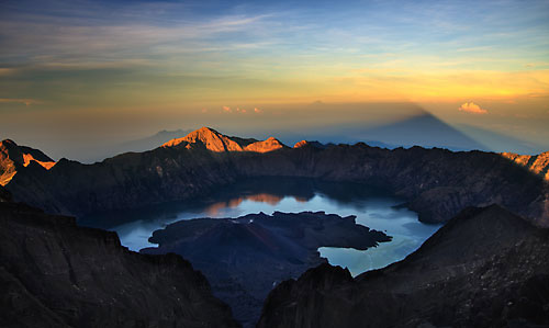
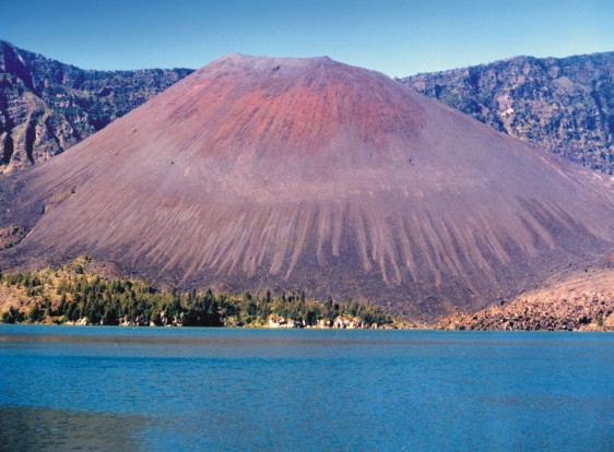
Untuk sekedar informasi, puncak yang kami sebutkan tadi bukan lah titik tertinggi [puncak abadi]. Gunung Sumbing memiliki beberapa puncak yang merupakan bibir dari kawah, diameter kawah gunung sumbing sengat besar, kurang lebih 800 meter.
Pemandangan dari puncak ke arah kawah

 Puncak [bersama teman-teman palawa]
Terimakasih sudah menyempatkan membaca artikel ini dan selamat ber'adventure'..

baca juga pendakian lainnya: Gunung Lawu,  Merapi,  Semeru,  Slamet     

Klayar, Keindahan Pantai Selatan


Pantai asri berpasir putih dengan ombaknya yang kuat menghempas tebing batuan karst..

Klayar adalah salah satu pantai di Kabupaten Pacitan, Jawa Timur. Mungkin anda sudah pernah mendengarnya karena beberapa waktu yang lalu banyak media baik cetak maupun elektronik ikut memberitakan hilangnya beberapa pengunjung yang terseret ombak di pantai ini. Ombak di pantai ini memang cukup besar, bahkan saya sendiri pernah menjadi korbannya, tapi alhamdulillah saya masih bisa berbagi cerita ini :)


Sebenarnya sudah lama saya ingin berlibur akhir pekan ke pantai. setelah mencari informasi ke beberapa teman, maka aku dan 3 sahabatku memutuskan untuk pergi ke Pantai Klayar. Kami berangkat dari Solo menggunakan dua sepeda motor, melewati Sukoharjo-Wonogiri dan memasuki Pacitan. Di daerah Wonogiri kami sempat menikmati tahu kupat, jujur rasanya maknyuss hanya saja porsinya terlalu sedikit buat ukuran kami,hee..
Kami tiba di Klayar sudah gelap, saat itu hujan lumayan deras sehingga kami langsung berteduh di warung yang kosong. Angin laut yang lembab begitu terasa, suara hempasan ombak terdengar jelas. Di warung yang terbuka ini kami mengeluarkan matras dan peralatan masak, mie instan, snack dan kopi hitam..

Pagi tiba, alhamdulillah cuacanya cerah, tampaklah landscape klayar yang kemaren disembunyikan oleh gelapnya malam dan hujan. Ternyata memang tidak salah, panoramanya begitu memanjakan mata ini. pasirnya yang putih putih dengan tebing-tebing batu karst di kejauhan menciptakan kesan tersendiri. Saat air surut terlihat batu-batu karang yang menjebak air laut bahkan ikan-ikan kecil juga, jika kalian mengamati banyak bulu babi di lubangnya.


Kami berjalan ke arah pantai yang bertebing, batu nya terlihat indah dengan bekas kikisan ombak laut. Meski air pasang belum terlalu besar, gemuruh ombaknya terdengar jelas menghempas tebing. Ada juga batuan yang menjorok ke laut seperti tanjung.


Saat kami tiba di atas batu tersebut ternyata sudah ada pengunjung lain yang tengah menikmati keindahan ciptaan-Nya sambil berburu gambar. Pemandangan yang paling menarik perhatian adalah air mancur dari air laut yang terjebak di sela-sela batuan, semakin besar ombak maka akan semakin tinggi pancuran air tersebut. Suara semburannya keras seperti air yang disemprotkan dengan tenaga yang begitu besar. Aku dan teman-teman pun tak mau ketinggalan untuk bermain dan mengabadikan dengan jepretan kamera poket hasil cumi alias cuma minjam [maklum aja ^.^..]


Tepian tebing yang Indah dengan hempasan ombaknya yang mendebur-debur membuatku ingin turun mendekat dan mersakan deburannya. Tapi apes, saat aku berdiri juah di tepian ombak yang besar datang tanpa aku melihatnya, saat ku sadari air sudah begitu dekat dan breessss... aku sudah di terjang, tubuhku dihantamkan batuan, beberapa saat aku terdiam kemudian rasa perih ku rasakan di tangan, kaki dan wajah. Keteledoranku harus dibayar, tapi syukurlah tidah parah...


pulang..
Setelah Puas menikmati dan bermain kamipun segera pulang karena berencana untuk singgah dulu di Goa Gong yang masih satu jalur dengan arah ke Pantai Klayar ini. 

About Rinjani National Park Lombok - Indonesia


There over 20 villages surround Mt. Rinjani and there are many routes up the mountain, but the main access is from Senaru in the north and Sembalun Lawang to the east. The challenging three-day Rinjani Trek route from Senaru to the crater rim (Plawangan), down to the stunning crater lake then on to Sembalun Lawang, is considered one of the best treks in South East Asia. Those heading for the summit usually prefer to start in Sembalun Lawang.

A model for ecotourism in Indonesia, the community-based activities are focused on the Rinjani Trek Centre in Senaru, the most popular starting point for the tough trek.

Developed with New Zealand Government assistance since 1999, the Rinjani Trek Centre embodies under one roof (satu atap) the unique partnership of the National Park, tourism industry and local communities that has been forged to manage and protect the Rinjani mountain environment.


WHAT YOU MIGHT SEE
Gunung Rinjani National Park lies within the major transition zone (Wallacea) where the flora and fauna of South East Asia makes a dramatic transition into that which is typical of Australasia. The Park has a rich variety of plants and animals, although they can be hard to spot due to the terrain and rainforest cover.
Sometimes seen early in the mornings is the rare black Ebony leaf monkey, known locally as Lutung.

The Long tailed grey macaque or Kera is common in Lombok and older males are seen on the crater rim.
image gallery

Rusa deer are forest dwellers and are occasionally seen along the Rinjani trek trail.

The smaller Barking deer or Kijang has an alarm call with a distinct dog-like bark. Look for the disturbed ground where the Wild pig or Babi hutan has been foraging. Also found in the forest is the Leopard cat or Bodok alas, Palm civet or Ujat and Porcupine or Landak.

A variety of colourful birds live in the forests of the Park. Perhaps the best-known icon of the Park is the Sulphur Crested Cockatoo that is not found any further west of Lombok.

Many of the forest-dwelling animals, insects, birds, civets and monkeys owe their survival to the wild fig tree or Beringin as a provider of food and shelter.

The pine-like Casuarina species, Cemara, are a feature of the grassy higher slopes.

Orchids or Anggrek are also a feature of the grassland areas, as is Edelweiss or Bunga Abadi growing above the tree line; it is a beautiful icon of the Park and one of our best-known sub-alpine plants.
image gallery
Rinjani Trek Centre
The Centre is located at the trailhead above Senaru traditional village. It offers information and displays for visitors on the trek, the National Park, Sasak culture and a range of activities available in Senaru.

Displays include maps, Park interpretation, village walks and environmental guidelines. All trek arrangements can be made here, cultural tours booked and purchases made of local produce and handicrafts.
 
Park Fees
Fees are paid at the Rinjani Trek Centre idr 150.000 /pax. They contribute to the protection, maintenance and management of the National Park, Rinjani Trek route, village attractions and visitor facilities.


Guides and Porters
Trained and licensed guides and porters are available. You will need three days and two nights to trek from Senaru via the spectacular crater lake, to Sembalun Lawang (or the other way). More time will be needed to explore the summit of Mt. Rinjani.


All trek arrangements can be made and paid for at the Rinjani Trek Centre. If not with a guide, please ensure you are well equipped and have knowledge of mountain safety.
image gallery
Warnings
The Rinjani Trek is a challenging mountain walk and you must be prepared with good equipment, warm and windproof clothing. Rinjani can attract severe storms, lightening and strong winds. When the weather is settled, the sun is intense and the nights frosty. Parts of the trail are steep and slippery. Beware of bad weather and risks of exposure to the wet and cold (hypothermia). If caught in an electrical storm, take shelter and avoid prominent ridges. Beware of snakes, and stinging insects and plants. Leeches can be a nuisance in the wet season.
Volcanic Hazards
Although Mt. Rinjani has not erupted in recorded history, Mt. Baru (2,363m) in the crater lake is an active volcano. It last erupted dramatically in 1994. Check the notice boards for recent hazards, and take advice from park staff and guides.
Spring Water
Fresh water springs are a feature of the trek and determine campsites. Your guide knows where these are. During the drier months (July-September) some springs completely disappear. Park staff and guides constantly monitor these water sources to determine their abundance.
image gallery
Radio Communications
You are advised to ensure that your guide is carrying a radio handset. Radios are available for rent at the Rinjani Trek Centre. In case of emergency the National Park authorities are also equipped with radio communications.
Telephone Communications
We recommended you to bring any mobil cell to mountain for Emergency

Beauty of Rinjani


GunungRinjani adalah gunung yang berlokasi di Pulau LombokNusa Tenggara Barat. Gunung yang merupakan gunung berapi kedua tertinggi di Indonesia dengan ketinggian 3.726 m di atas permukaan laut serta terletak pada lintang 8º25' LS dan 116º28' BT ini merupakan gunung favorit bagi pendaki Indonesia karena keindahan pemandangannya.

 Gunung Rinjani

Sunrise view :)

The rolling clouds wuuzzz!

Danau Sagara Anak & Anak Gunung Rinjani


Ini Rinjani yang gua pajang di kamar :)
Gua ambil dari koran Kompas hehe 

Rinjani meletus tahun 1994 :O

Kondisi terbaru Rinjani
Taman Nasional Rinjani bakal ditutup mulai tanggal 5 Januari 2012 
Menurut orang-orang sih, the best time to trek in Rinjani itu sekitar April sampai November. Mudah-mudahan April 2012 Rinjani udah bisa dibuka kembali ya, so pendaki juga bisa ngelaksanain ekspedisi mereka di sini. Di gunung Rinjani.

Gunung Semeru bergoyang


Metrotvnews.com, Lumajang: Gunung Semeru di Kabupaten Lumajang, Jawa Timur, mengeluarkan gempa embusan atau pelepasan energi dari perut gunung sebanyak 60 kali. Gempa embusan terjadi selama 24 jam terakhir atau Ahad (25/12) tercatat dalam seismograf PPGA Semeru di Gunung Sawur, Desa Sumberwuluh, Kecamatan Candipuro, Kabupaten Lumajang.

Gunung Semeru memiliki ketinggian 3.676 meter dari permukaan laut (mdpl). "Gunung tertinggi di Pulau Jawa itu mengalami gempa embusan sebanyak 60 kali, namun masih dalam batas kewajaran gunung api yang berstatus Waspada," tutur Petugas Pos Pengamatan Gunung Api (PPGA) Semeru, Sofyan, Senin, (26/12).

Dalam seismograf juga mencatat aktivitas Gunung Semeru selama 24 jam terakhir mengalami gempa tremor lima kali, gempa vulkanik satu kali, dan gempa guguran dua kali. "Kalau ada gempa-gempa embusan itu malah bagus, artinya tidak terjadi penumpukan energi karena secara perlahan mulai dikeluarkan. Kalaupun terjadi letusan, itu tidak akan besar," paparnya.

Ia menegaskan, status Gunung Semeru masih tetap Waspada (Level II), sehingga masyarakat di lereng gunung tersebut tidak boleh beraktivitas dalam radius empat kilometer dari puncak Semeru. "Tidak ada peningkatan status karena Semeru masih berstatus waspada dan terjadinya guguran karena material vulkanik di kawah Semeru (Jonggring Saloko) longsor," jelasnya.

Sejauh ini, puncak Gunung Semeru tidak bisa terpantau dengan jelas dari PPGA Semeru di Gunung Sawur. Cuaca mendung dan tertutup kabut menjadi penyebab.  "Saya mengimbau warga tidak mudah terpancing dengan isu-isu yang meresahkan terkait dengan aktivitas Gunung Semeru karena petugas PPGA selalu berkoordinasi dengan Badan Penanggulangan Bencana Daerah (BPBD) Lumajang," katanya menambahkan.

Pemerintah Kabupaten Lumajang menetapkan enam kecamatan masuk dalam zona merah bahaya lahar dingin Gunung Semeru seiring dengan semakin tingginya curah hujan selama musim hujan dan aktivitas Semeru. Enam kecamatan adalah Kecamatan Pronojiwo, Tempursari, Pasirian, Candipuro, Pasrujambe dan Kecamatan Tempeh. Kecamatan-kecamatan tersebut dilalui tiga alur utama aliran lahar dingin Gunung Semeru yakni daerah aluran sungai (DAS) Mujur, DAS Glidik dan DAS Rejali. (Ant/BEY)

Saturday, December 17, 2011

Karaton Surakarta Hadiningrat


Since February 17, 1745, Susuhunan Pakubuwono II and his family had occupied the new palace or karaton located along the banks of Solo River, the longest river in Java. The former karaton in Kartosuro (10 km west of Solo) had been abandoned due to severe damages. It was not a proper karaton for the Susuhunan (king) anymore, after being ransacked on 1742 by the invaders. Pakubuwono II with all his family and subordinates made a day long royal procession from Kartosuro to Surakarta. The city of Surakarta could easily connected to east Java main coastal centers such as Gresik, Tuban via Bengawan (river) Solo. This 'river connection' was one the reasons to move the palace to Solo. Pakubuwono means 'center of the world' (paku : nail, buwono : the world).
The king sat on his royal wagon, Kyai Grudo escorted by high ranking officials, troops, regalia carriers, bringing the pusakas (heirlooms) and other important things to be used in his new palace. The convoy includes also the sacred gamelan, waringin (Banyan) trees, horses, elephants and a special chamber Bangsal Pengrawit. Upon arrival at the new karaton, he announced that starting from today the capital city of the kingdom was Surokarto Hadiningrat (suro : brave, valiant - karto : prosperous - Hadi : great, precious - rat : state).
Coming from the north side of Jalan Slamet Riyadi through a thoroughfare (gladak), a visitor arrives in the North Square (alun-alun Lor). In the center of Alun-alun, there are two waringins (Banyan) trees symbolizing protection and justice.
The throne hall Sasono Semowo or Pagelaran faces the square. In the old days, it was from this hall, the Susuhunan or king delivered his massage and received report from his government read by his Patih (chief minister). Further south, several steps up, there is the Siti Hinggil (high ground) where the Garebeg ceremonies started (in separate article: garabeg in Solo and Jogya).
Passing through the main gate or kori of Brajanala (braja: ray - Nala: feeling) one enters the fort Baluwerti on Kemandungan square. Enter to Sri Manganti, where one has to wait for audience with the king. And there is the main location called Kadaton. In the center is the main throne hall Sasono Sewoko, where the king received obedience from his court family and subordinates. It is also a place he practiced meditation (samadi). There is a small Pendopo (hall) called Pringgitan, where leather puppet (wayang kulit) performs from time to time. Next to Sasono Sewoko is Sasono Handorowino where royal banquets are given.
Leaving Kadaton to south, there is the Magangan court, where the court dignitaries entered the sanctum along this route. There is a pavilion of meditation for princes. There is a sacred meteorite on the rear bank of the pool. From here southward, passing the gate or kori of South Brojonolo, then Sitinggil Kidul, one arrives in the South Square (Alun-Alun Kidul) The Palace's elephants and buffaloes grazed here in the old days. Due to the existence of the elephants with its ivory trunks, this place is popularly known as Gading (Ivory).
Taking lessons from Kartosuro Palace, which were easy to be attacked by enemies, the new Surakarta Palace fortified itself.
So, the Alun-Alun was also meant to be a battleground to resist any attack. Several batteries of soldiers were installed in Pagelaran and in front of it (Gelar = formation of troops; Pagelaran = a place where battle tactics are decided). The routes encircling the Alun-Alun are called Supit Urang (Supit-pincers; Urang = crab), symbolizing a tactic to defeat the intruders.
The reserves (of soldiers) were held in the square of Kamandungan, Sri Manganti was a rest place.
In Baluarti, there were rice - barns, arsenal and ammunition depot, and stables for horses of the cavalry and the special garrison of the king's guard (Tamtomo). The palace is also a place of high spiritual meaning of old Javanese faith. As there are seven stairs and seven gates at Candi Borobudur, there are also seven squares and seven gates (Gapuros) at Solo Palace.
        
There is Panggung Songgobuwono (panggung-tower ; songgo-to support ; Buwono the world) in Baluarti, a tower with octagonal form. Some believe that it is a place where Sri Sunan (a popular name for the king) continued the tradition of his ancestors to meet with the Goddess of South Seas (Kanjeng Ratu Kidul) at least at the anniversary of his coronation.
West of Kedaton, there is a place called Mantenan, where there was bandengan, a fishpond with gurameh fishes and turtles (symbols of long age of life). In the old days, Sri Sunan delivered the teaching of life philosophy and cleaned his heirlooms. In the high ground he did meditations and there is a mosque - Pudyosono (a place to worship).
Karaton Surakarta as one of the stronghold of Javanese culture is opened daily to be adored by visitors. It has a museum and art galery where some precious collections are exhibited, such as keris (daggers), masks, leather puppets, etc.
At present, the King of Surakarta is Sri Susuhunan Pakubuwono XII.

Museum Sonobudoyo Jogja


Museum Sonobudoyo Jogja, far from being boring. The first came in, a cool atmosphere because air-conditioned room. The order is good and there is information IT (computer touch screen to provide information about the items in the museum). Consider the coverage of journalists KoranJITU Bernadetta Estu following Princess. NOW, all museums are no exception Museum Sonobudoyo used as one of the education center. The reason is simple, because every object has a history.
That is why, implanted very well that the principal function of the museum is to store, treat and presents historic bendabenda. "Our forwards have a lot to improve itself, should be presented more and increase the space. It should be further enhanced in the promotion, more familiar with a lot of open networking with partners, infrastructure must be improved participate. Deploying event is also important to be better known by the public, especially tourists, "said Diah Tetuko Suryandaru, Guidance Section, Information and Documentation Museum Sonobudoyo Jogja to JITU Newspapers. Currently, the facilities at the museum are complete.
There are showrooms, IT information, which contains bukubuku libraries, archives and naskahnaskah or scripts, puppet shows and other public facilities. To further add to the comfort of visitors, there are renovation and revitalization of the Museum Sonobudoyo are expected to finish in December. "After that, we will genjot promotion programs. Who has done such exhibition will be increased further. Also competitions like drawing and photo competition, "said Tetuko. Sonobudoyo Museum is the Regional Technical Implementation Unit at the DI Jogjakarta Provincial Cultural Office. Its location in the city center is in a strategic location, being within the Yogyakarta Cultural Center is a lot to get attention from various parties, both from within and outside the country. Building Museum is home joglo Sonobudoyo with Kasepuhan Cirebon Palace mosque architecture. When visitors want to enter the Museum Sonobudoyo, will first pass through a gate in the form of Semar Tinandu, roofed joglo. On the wall of the east side of the gate there is an inscription which marks the founding of this museum, namely in 1935 in the Javanese calendar which falls in 1886. More entered the room again is called the gazebo. Its function is to receive visitors in large numbers. In this room also, exhibited two sets of gamelan. Namely, Gamelan Kyai Mega Chance, her tone and Slendro Pelog.
This ancient device from Cirebon area in the 19th century. The second, Gamelan Kyai and Nyai Riris Sweet Jogja style that smacks Slendro and Pelog. Not only historical objects on display in Sonobudoyo. This tourist location also has a multifunctional auditorium. This facility can be utilized by the community. Auditorium Space Museum building complex is located within the existing Sonobudoyo I Trikora No. 6 at Jalan Jogja. The building comprises two floors and can be used for seminars, workshops, meetings and other work. The room can accommodate 75 people on the first floor and 100 on the second floor. There's more versatile space in the Museum Sonobudoyo II at Jalan Mijilan No. I, Dalem Condrokiranan Jogja. In 1975 Space Museum Conservation Laboratory Sonobudoyo completed. This room is responsible for maintaining all the immediate collection of the museum objects to get the handling of security on a regular basis.
"This activity is in accordance with the basic tasks of the museum. Ie, collect, preserve, maintain and preserve the collection objects. Collection of objects so that safety is more assured. Some equipment has been owned by a good laboratory for analysis and perform treatment of collections, "beber Tetuko. Another facility is the library. Books and manuscripts found in libraries mostly describes the culture of Indonesia. Library Museum Sonobudoyo can be utilized for the entire community. (Comes from the museum website Sonobudoyo)

Mystery of Mount Lawu

Lawu stature haunted by the mystery and save the three main peaks: Price Dalem, Prices and Price Dumiling Dumilah the myth as a sacred place in the Land of Java. Price Dalem believed the local community as a place of King Bhrawijaya pamoksan Pamungkas, believed to be the spot price Dumiling pamoksan Sabdopalon Ki, and Price Dumilah is a place full of mystery which is often used as a venue to be if the mind and meditation skills.


The legend says Lawu mountain is the center of spiritual activity in the Land of Java and there are close links with the traditions and culture of the palace, such as ceremonies harbor every month Sura (sacred) done by the Sultan Palace. From the vision of folklore, there is an interesting local myths and convincing Lawu who the real ruler of the mountain and why it is so authoritative and impressive armature for locals or anyone who intends resort and mesanggarah.


Anyone who wanted to go to the main peak is sufficient knowledge or weweler taboos or written regulations that the prohibitions for not doing something is both deeds and words, and when taboos were violated in the perpetrator is believed to be an unlucky fate.


The story starts from the end of the Majapahit kingdom (1400 AD). Once, in the era of the Majapahit empire tides, was enthroned as king of the Earth Sinuwun Nata Bhrawijaya Ingkang Jumeneng Kaping 5 (Pamungkas). Two famous wife Dara Petak is the daughter of mainland China and Dara Orange. Born son of Dara Petak Jinbun Fatah, of Orange was born the son of Prince Dara Katong.


Jinbun Fatah after the adults appreciate the confidence that is different from his father a Buddhist. Fatah Jinbun a Muslim. And with the fading of Majapahit, Fatah founded the kingdom in Jinbun Glagah Wangi (Demak). Seeing such circumstances, the liver masygullah King. Will Kerta Majapahit era can be maintained?


As a wise king, one night, he finally pleaded meditation guide the Almighty. And wisik came, the message: it's time to fade and the light of Majapahit kedaton revelation will move to a new kingdom grew and the entry of a new religion (Islam) is already inevitable destiny and again.


At night it's also the King accompanied by only a faithful pemomongnya Sabdopalon secretly left the palace and crossed the service and eventually climbed to the summit of Lawu. Before arriving at the summit, he met two men pennant (bayan / hamlet head) that is Dipa Menggala and Wangsa Menggala. As a loyal courtiers two banners that would not bear to let his master granted. Intentions in their hearts is mukti died with the King. Syahdan, The King with three servants and even then at the peak price Dalem sampailan.


At that time King utter: O our faithful abdiku was time for me to recede, I must muksa and leave this busy world. Dipa Menggala to you, because you picked up your loyalty to the ruler of the mountain Lawu and oversees all magical creatures (fairy, genie and the like) with the region as far west as the Merapi / Merbabu, to the East until the Wilis mountain, to the south to the southern coast, and to the north up to the north coast with a degree of Sunan Gunung Lawu. And the House of Menggala, you picked up as patihnya, with a degree Kyai Starling.


The atmosphere was quiet and see the drama of that kind, could not withstand the turmoil in his heart, Sabdopalon even ventured to say to the King: How could this happen to the King? If so the servants had also said goodbye to part with the King, I will go up to the price Dumiling and left the King here. And two masters and servants and even then separated in a heartwarming atmosphere.


King short story Barawijaya muksa at any price Dalem, and Sabdopalon moksa in price Dumiling. Sunan tinggalah Lawu the Lord of the mountain and Kyai Starling is due to supernatural power and perfection of knowledge then becomes magical creature who has so far remained faithful to carry out duties as mandated by the King of UB.


Other places are believed to be mysterious by the locals in addition to three peaks are namely: Spring Inten, Drajat Spring, Spring Panguripan, Jalatunda Wells, Crater Candradimuka, Repat Overheated / Cakrasurya, and Pringgodani. What is the situation sepeninggak Majapahit King? It is said that as a running task is Prince Katong empire. This figure as a powerful myth and supposedly also in Ponorogo muksa still Lawu slopes of the mountain regions of Southeast.